
The second half of my week-long hiking trip led me close to a place I visited a month before – this time, on the other side of the Czech-Polish border.
Since the ‘Park Narodowy Gór Stolowych’ (could be translated as ‘table mountain national park’ from Polish) is too large to walk through its beauty in a single day, I decided to split it into three parts: west, northeast, and southeast – so we could see as much of it as possible.
Day one: western part
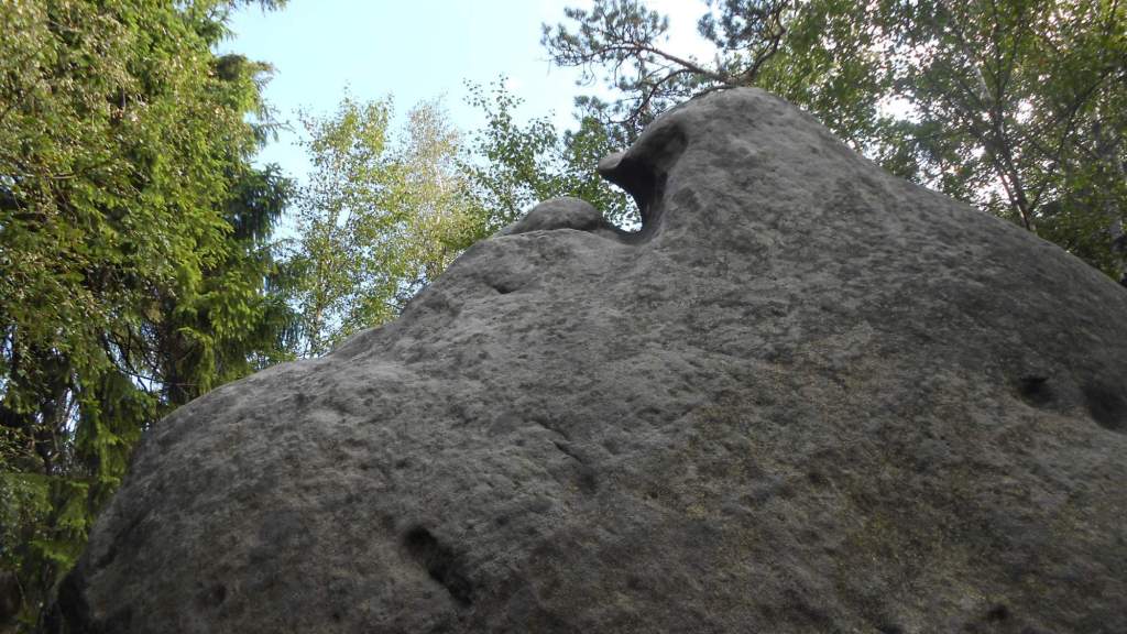
I’ve planned the biggest ‘selling points’ of the area right for the first day: the ‘Szczeliniec’ and ‘Błędne skały’ mazes. As for the names, ‘Szczelina’ means something like ‘narrow gap’ and the german name for the peak, ‘Heuscheuer’ supposedly something like ‘haystack’ (though I am not sure on that). As for the other, the name comes pretty much from the ‘rock maze’ term. Both of those places are accessible for a fee of 10 PLN (~2€) each while the rest of the national park is open without entry fee (but movement is limited to marked trails and the few roads).

Our hike began above the ‘Radków’ town, in a turn near a small waterfall, from which we went pretty much directly towards Szczeliniec. We reached the chalet (and the entry to the paid trail) at 9:45, after an hour of walk – before the main rush of people (more on that later). Despite the name, most of the trail leads between oddly-shaped rocks, not so much through narrow gaps. But, the truth was: we just had to wait for it.


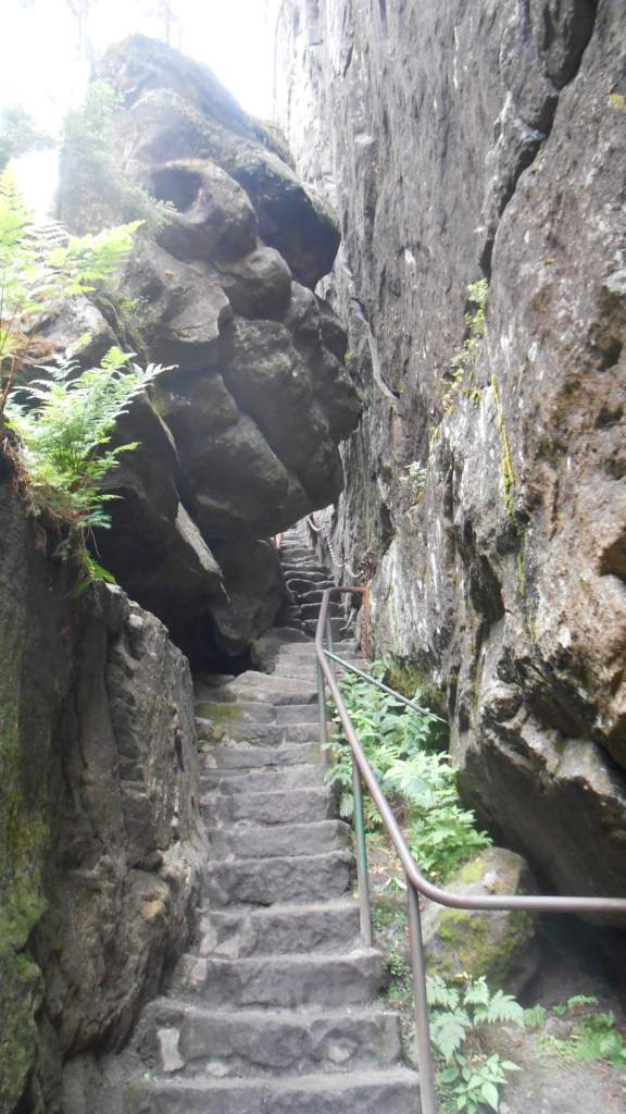

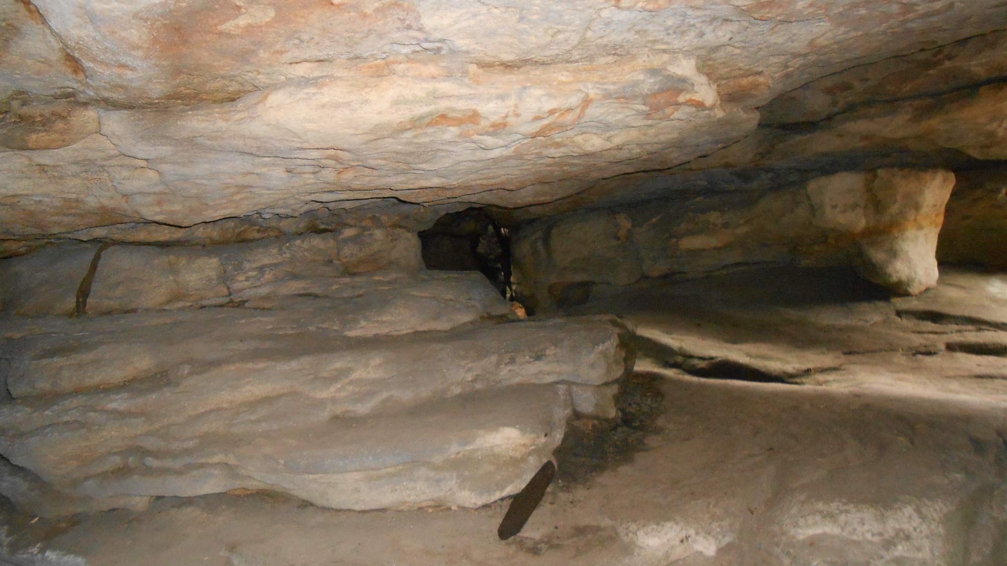
We also took a few pictures demonstrating the narrow gaps, even though we were to get a taste of something even tighter later…

And, before you ask: I left my sunglasses at the hotel, for luck with weather. Works 95% of the time. Anyway, after passing through this part, we had to walk around the northwest portion of the area to eventually reach the second part. That’s where things went a bit poorly: we got there around 12:45, by which time a long line at the entrance has formed (we waited ‘only’ 10 minutes) and walk through the very popular (and very narrow) trail was a slowly-moving line. So, should you ever want to go there… do yourself a favor and be at the entrance before 10:00 and the main influx of people.

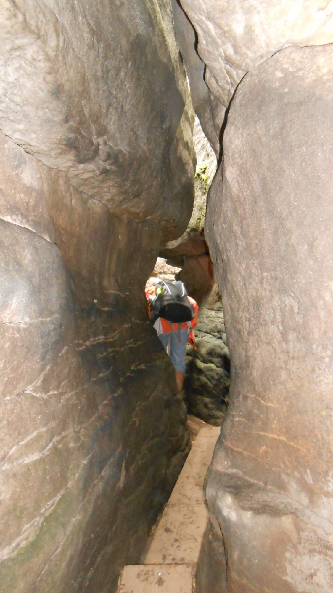

With the crowds and the narrow gaps (for which I sometimes had to remove my backpack, squeeze through, take backpack through, put back it on…), taking photos was troublesome and while I made around 40, few were of enough quality for me to post them. Maybe I’ll return there in a few years (in different time of year and definitely not around noon).

Some sources mention the place was used for some scenes in Chronicles of Narnia: Prince Caspian – I suspect this is an aerial shot of the place (picture source: IMDb).

After leaving the rock maze, it took us a walk through nice woods around the second highest plateau in the mountains, to eventually wind back to Szczeliniec’s south slopes and the village Karlów where our hike ended.
Day two: southeastern part
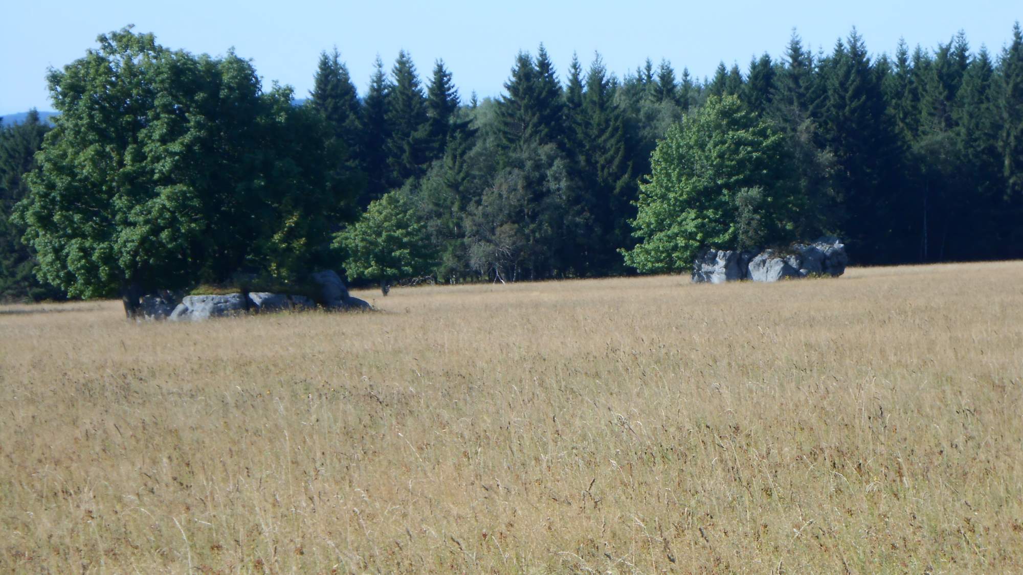
The second day took us to a bit different place first: while the area is mostly forested, there’s one place where the landscape features a long field with (relatively) smaller rocks strewn around.


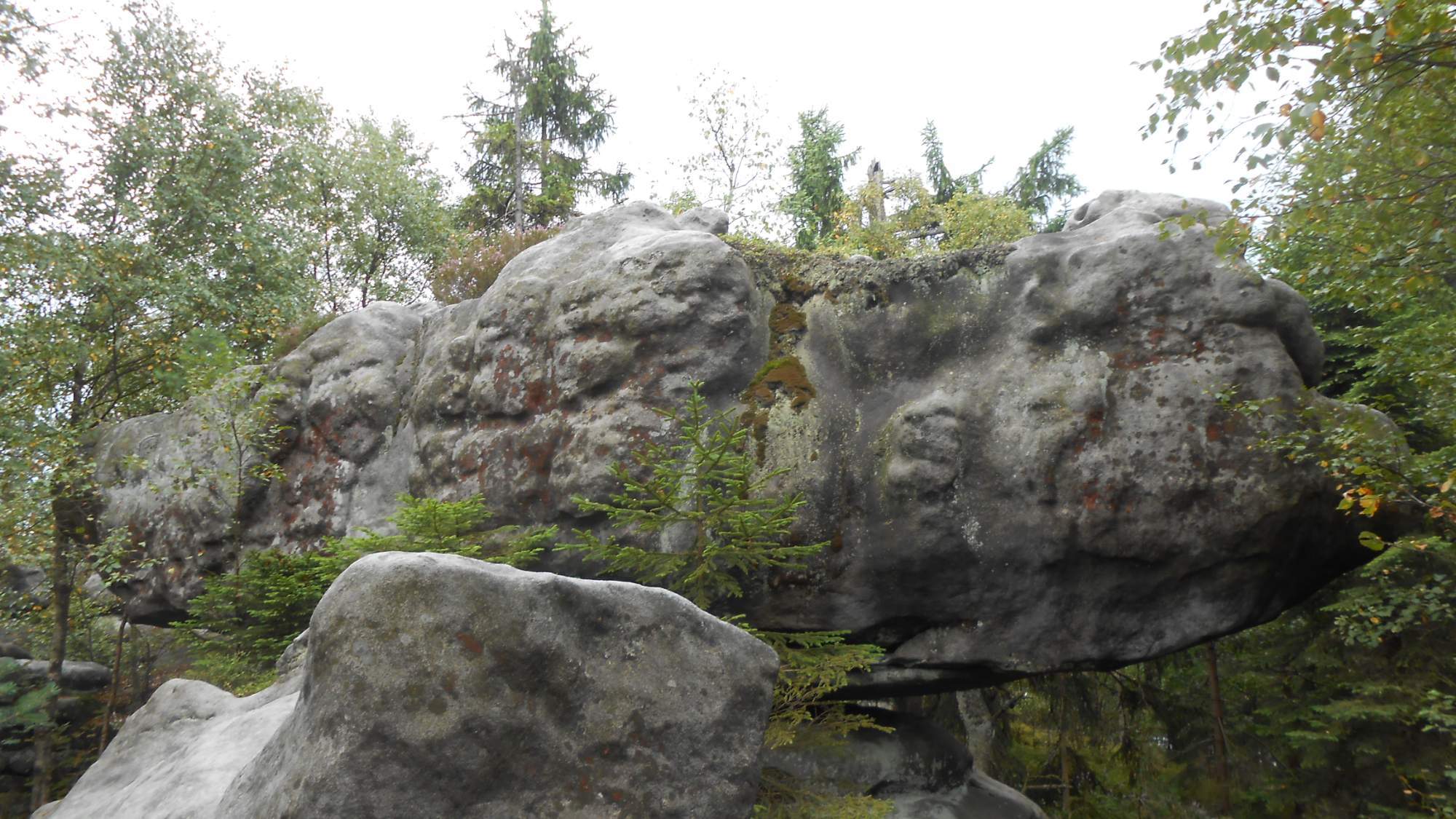
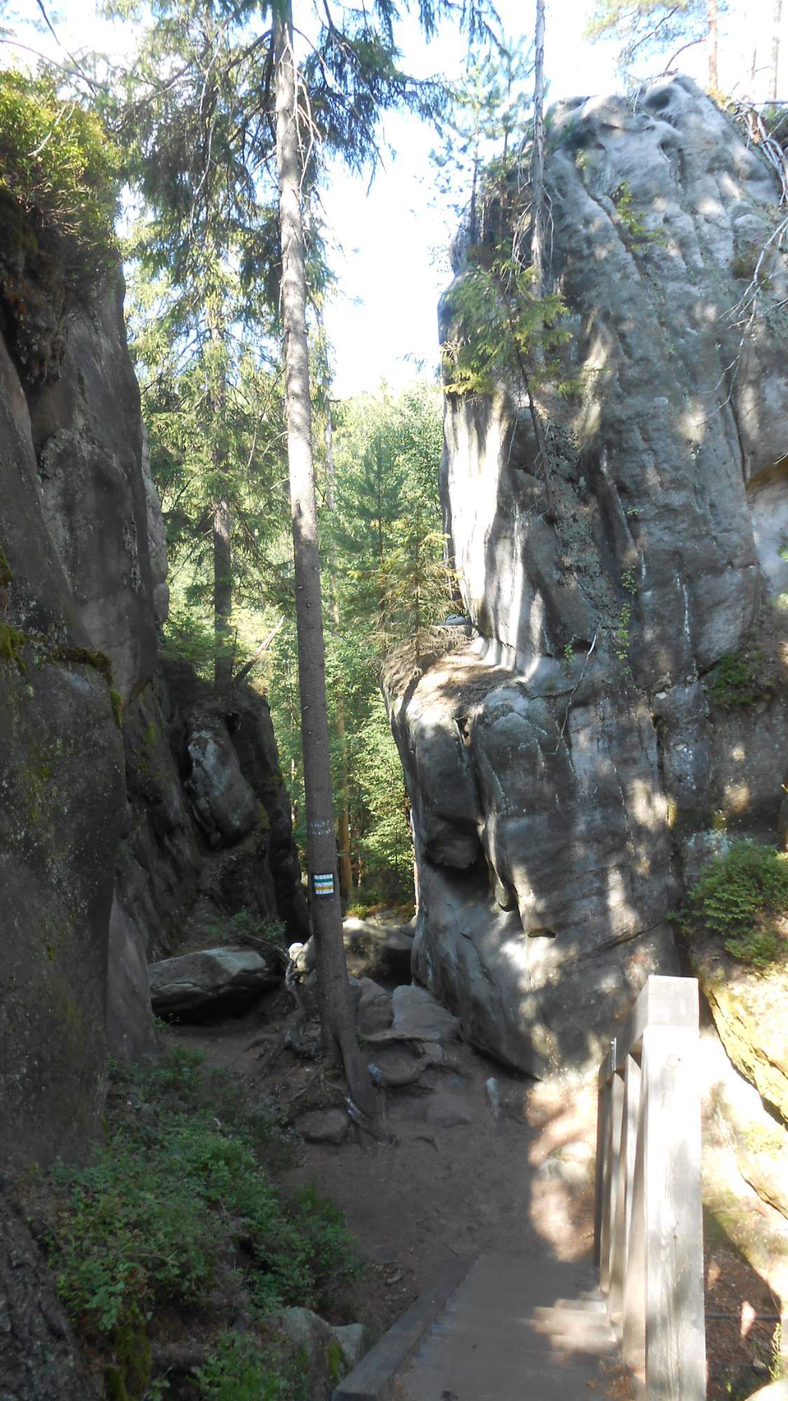
Then, we walked to several more rock formations – the ‘Białe Skały’ (white rocks) area – but some were partially obscured by the forest, which made taking decent photos difficult and a whole rock (let alone the whole formation) pretty much impossible.


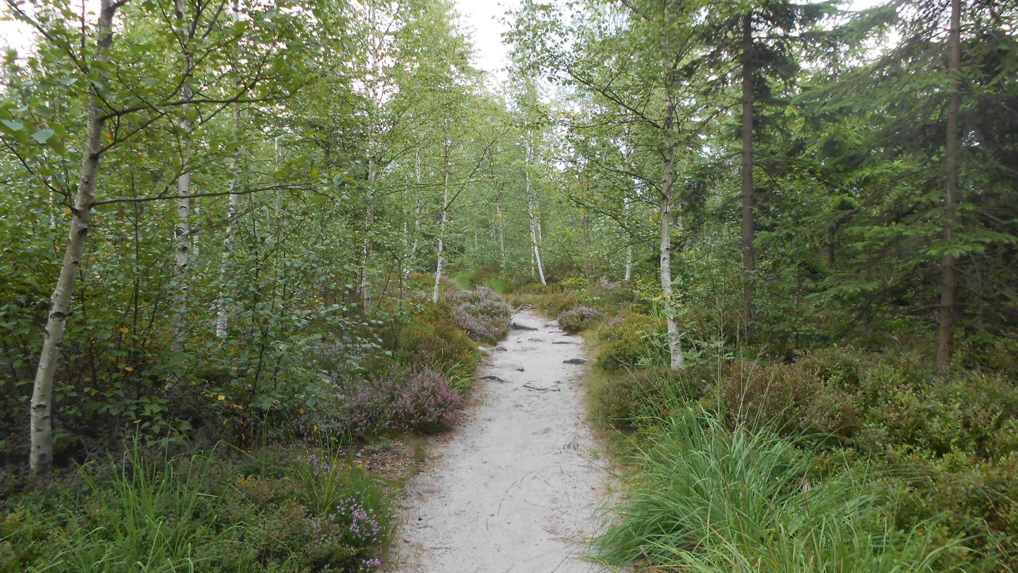
After passing that place, the nature of the trail changed: we walked a short distance from the end of the plateau forming the table mountains, in what was once a spruce forest. As spruces suffered damage by bark beetle, droughts, pollution, and wind in the last decades, the place is now turning into mixed or birch forest with a dense undergrowth of blueberries (remainder of the spruce forest), tall grasses, moss, and heather – creating a beautiful mosaic if growing all at once.

It led me to some thoughts as spruce forests close to my home suffered major damage due to droughts and bark beetle infestations – and only now someone had the idea to try planting birches. Mostly because they grow relatively fast (which helps to slow down erosion) and can be ‘planted’ by just taking a few buckets of their seeds and throwing them around which is fast and low-effort work, compared to planting pre-grown saplings.

Then, we left the plateau and turned to descend from the national park towards the spa town Duszniki-zdrój, which was still quite a walk, passing around a pasture guarded by a nervous dog and eventually finished the day by a walk to the spa park.


Day three: northeastern part
After the previous days, when rain usually waited until the night, our luck has ran out. Even before the rain, we had to add 2km to the hike because the town where we were to start, Wambierzyce, has three roads in – two with a weight limit disqualifying our bus and the third with a bridge (on now defunct and demonted railway – apart from the bridges) too low to pass below. The massive church there is undergoing repairs so what was seen of it was the scaffolding around it. Bah.

Shortly after we left the city, the first rain shower came – and lasted for some 45 minutes.

The area we visited this day was about a large amount of rocks, a great deal of them erroded in its lower portion more than the upper, strewn around in the woods. Those are usually created by protruding from a shallow sea (which erodes the ‘leg’, forming a mushroom-like shape). In this case, the sea existed in mesozoic era.


I was also prevented from taking as many pictures as I’d like to – the first day and the use of flash in the labyrinths drained my battery more than I expected, leading to ‘low battery’ warning shortly after we reached the first part of the area.
The weather continued with its ‘out of season April joke’ nature, as it turned into sunny for a while, then back to cloudy, and when we reached the last major formation, it was a storm looming on nearby again…

Despite the thunder in the distance, we walked most of the remainder to Karlów (same place as the first day, from different side) in a light rain which ended when I was maybe 20-30 minutes from the destination.

Here comes a somewhat-funny moment: unlike the previous days, when the pick-up time was 17:00, I wanted to move it to 16:00 due to the hike being shorter. I was eventually persuaded for a compromise at 16:30 but most of the people, with the coming and passing showers, made it before 15:30. At 15:59, it started to rain again – and much more, so the pair who persuaded me the most to delay it (and reached the parking at ~16:15) got a bonus round of rain while I could keep a smug ‘I told you’ face.
And this pretty much wraps this three-day ‘adventure’. We had a shorter hike on the next day as well, after which we rode home, but that one was just an epilogue without much to talk about.
Before I wrap this up, I wanted to put some things into perspective. So, here’s a map depicting the three hikes (orange, blue, green) and the two hikes in the previous month on the Czech side of the mountain range (black and purple lines).
And that’s all from me for today. I have one more August hike to cover in another post, presumably in a week. See you soon!
Note: all pictures are taken by me unless stated otherwise.

Pingback: Hiking: Summer’s end | Tomas - the wandering dreamer