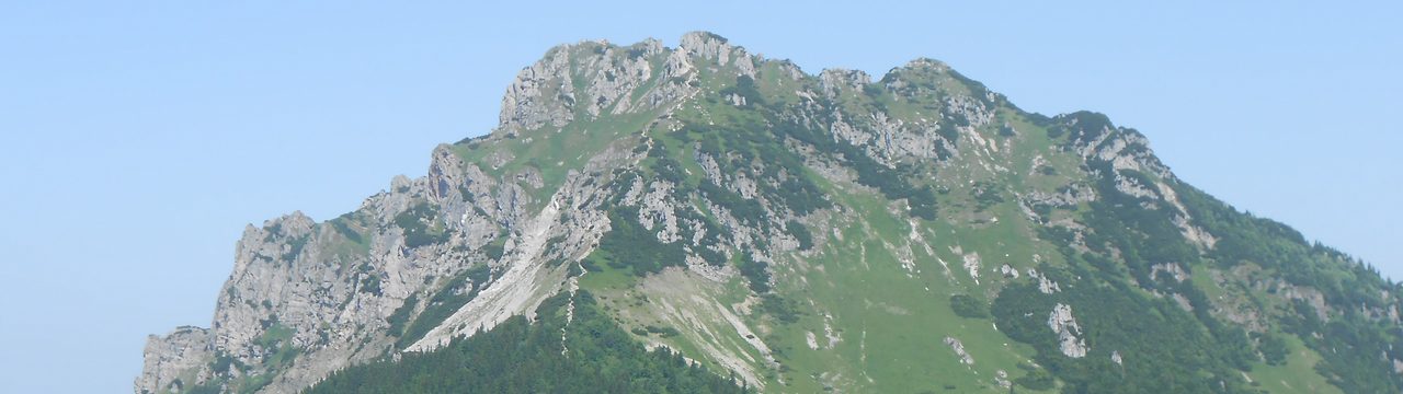
In today’s post, I’ll continue where I left off and share my memories of my August week-long hiking trip, along with some photos.
After the easier fourth day, the fifth day was a longer hike to the two tallest peaks on the Czech side of the border (the highest peak of the whole mountain range is on the Polish side and, surprisingly, no trail leads to the peak). The hike started at a pass quite high in the hills, so getting near the first peak (lower by two meters) wasn’t exactly difficult – I just had to do a wide, gently ascending loop around.
The heatwave had made its mark on the highland bogs, which often don’t look like a bog anymore, with small puddles of water in dried-up mud rather than a patch of wetland.

Ascending to the first peak was a bit more intense at the end, but the result was well worth it. Similar to some places from the second day, the peak features some large rock formations, made even nicer by the rowan trees full of berries adding more color to the scenery.


Leaving the peak meant returning to the pass, which was a steady downhill path that allowed me to go at a higher pace. From the pass, the trail I took was mostly level for quite a while, and it only ascended slightly by the time I reached a rocky lookout that I remembered from my previous stay – back then, we had quite a foggy weather, and the railings were in maintenance, so we didn’t even go up.

The view from the lookout was limited, given its position, but still nice.

As this lookout was on a side branch, I finished the V-shaped detour and shortly returned to the main trail, leading me towards the main peak. After enjoying gentle trails for hours, the ascent was quite harsh, especially the first half, until it eased up a bit. The wooden walkways suggested that this part of the hills can also get quite damp, especially during autumn and during spring melts.

The peak itself was quite crowded, including the lookout tower, so I only took a couple of photos and didn’t stay long.

For a moment, I contemplated making another detour to see one more rock formation that wasn’t on the schedule and that I didn’t see back in 2013, but I decided that I’d like to return here again in a few years, and skipping it might be a motivator. Plus, that would push me way past 30 km again, which I didn’t feel like doing that day.

So, instead, I enjoyed the way down and found an ice cream stand in the town and enjoyed some extra time to relax.
The sixth day led us to a place that’s quite interesting when it comes to its weather patterns: a plateau surrounded by hills that, while not exactly tall, can trap the cold air which, combined with the moisture from the wetlands, turn it into a place known for very cold mornings, especially in winter. Even in summer, the mornings can be freezing (which wasn’t the case now), while the days will be quite warm. In winter, morning temperatures can drop even below -30°C.
The trail I took led upriver and had a small waterfall near the start.

I didn’t go straight to my destination, but took a small detour to a chalet on the Polish side of the border.

I neared my destination in the early afternoon. With all the extra time, I decided to go around some of the rocky peaks nearby. Some of them weren’t as easy to take photos of, located in the woods.

Taking photos there also wasn’t easy, and I had to improvise a fair amount to get to a position and then find a way to set up my phone with a timer. But I managed to take some photos to prove that I was there. On the way to the second rock formation, I passed some larger boulders along the trail.

Then, I descended from the peaks to the plateau. As in other places, the heat made its mark on the landscape, which didn’t resemble a highland moor as it should.

And the sprawling wetland was reduced to a handful of puddles in what matched a savanna more than a swamp.

After finishing the trail through the drying wetland, I made it up the peak above the village for a final view, before finding a place in the shade to enjoy a cold beverage.

The seventh day – final before our departure – was also planned to be a “wildcard” – the official plan suggested a loop around the hills north of the hotel, but a lot of people opted to see the ZOO or museums in the town instead. This provided a view of the peaks south from the town I visited during the fourth day.

Here, too, I could see some smaller rock formations…

…as well as one with a handy plateau that is used as an amphitheater.

Given that these trails were mostly through woods lower in the hills, many rock formations were tightly between trees and thus hard to take photos of, especially if the only clear direction was straight against the sun and would lead to overexposed photos.

There were some views to enjoy, at least.

And, eventually, a small waterfall.

As with the first day, our journey back home was planned with a short stop. I took it easy, first going to a small lookout where a wetland area between two rivers is being partially restored by diverting some water from one of the rivers to create habitat for wetland birds and plants.

And to a nearby fort built in the late 1700s, which never truly served its purpose, as it was never besieged, though it was used as a prison or field hospital during the World Wars.

Even here, it was quite clear that the dry weather had made its mark on the landscape with the trimmed lawns being even more susceptible to drying out.
All that remained was to get back to the parking lot, with a short detour to grab an ice cream by the river, and then it was time for the final journey home.

