
After the fourth day, the halfway mark of my holiday, I’ve had walked around 100km. And I was nowhere near done…
Day five: Basalt intermezzo
The fifth day was a break day for our driver, which meant we were to spend the day whichever way we chose. Many people decided to go sightseeing through the town Mělník, others visited nearby places (such as the Říp peak, one of the Czech national symbols). I, however, had a different plan – ever since learning of them in geography, I was somewhat fascinated by basalt spires and wanted to see some in person. Fortunately for me, there was a place I could reach during this day off.
The journey itself was a bit tight – I needed to take two buses, with just 5 minutes gap for transfer. The first bus arrived 4 minutes late when I boarded, and was increasing the delay to 8 minutes. I had begun to accept that the follow-up bus is gone and that I’ll need to adjust my hike plan (fortunately, the transfer was to happen just 8km from the site I was to visit). With a stroke of dumb luck, the follow-up bus was also running late and I caught it – just barely.
A while later, the bus dropped me off just a 5-minute walk away from the site I’ve wanted to see… pretty much since I was 12 or so. Well, 20 years later, here I am.

Almost overcame with joy, I walked around the not-so-large basalt formation, taking photos from various angles. The formation itself is some 30-35 meters tall at the tallest columns. The formation itself is ca. 50×50 meters so, in a way, quite small. But exposed basalt columns are quite a unique sight in my country…
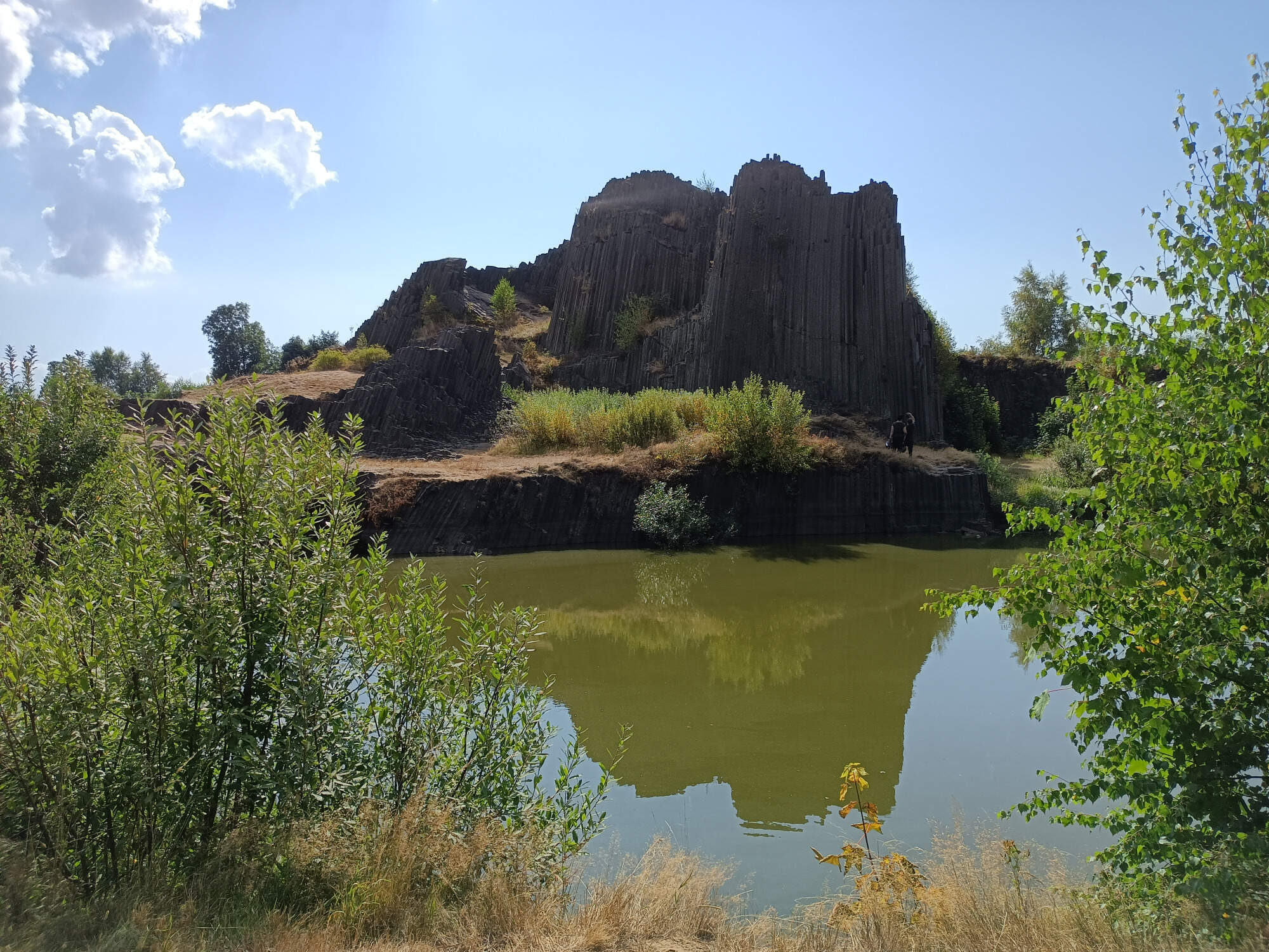
The iconic photo often taken, showing the reflection in the nearby artificial lake (created in the late 1800s by mining the basalt) wasn’t as clear in my take – dust and pollen turned the water murky. And, given it’s some 20-30km downwind from the site of a major forest fire, possibly even ash.
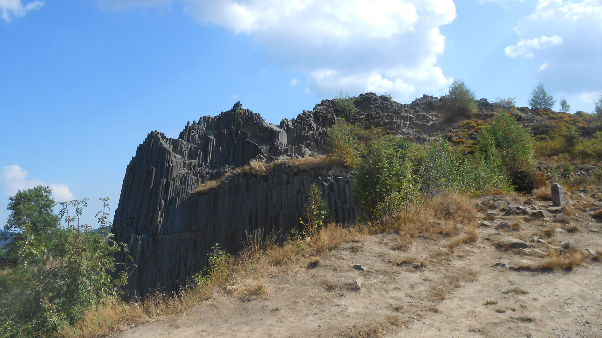
The formation is known in Czech as “Panská skála” (translation of German Herrenhausfelsen, which could be translated into English as “Manor rock”) or “Varhany” (Organ).
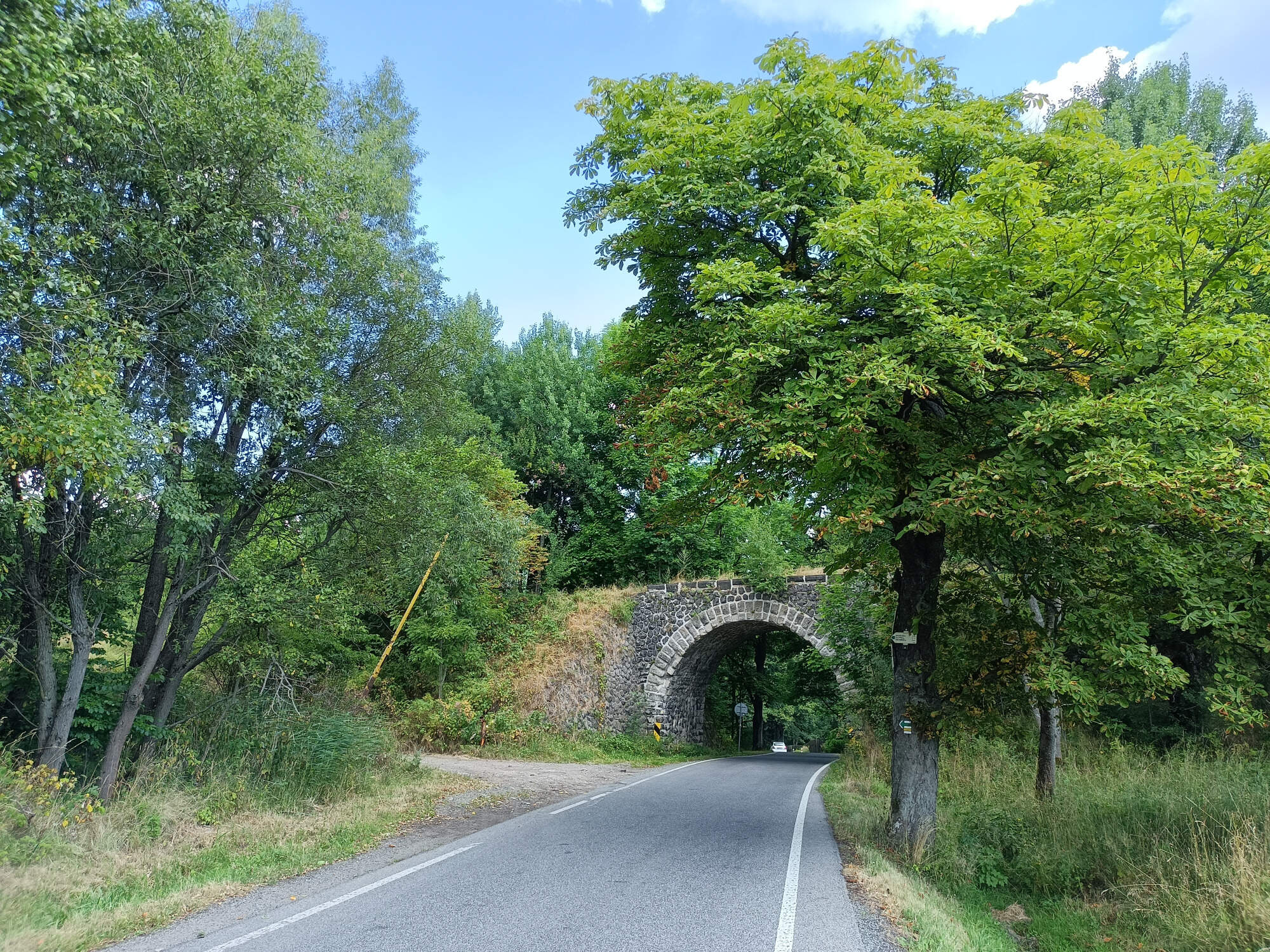
After leaving the site, I headed towards a nearby peak. On the way, I walked around an overgrown railway bridge – this section of the railway was closed in the late 1980s and vegetation had over 30 years to take over, so far with no damage to the still-standing bridge.
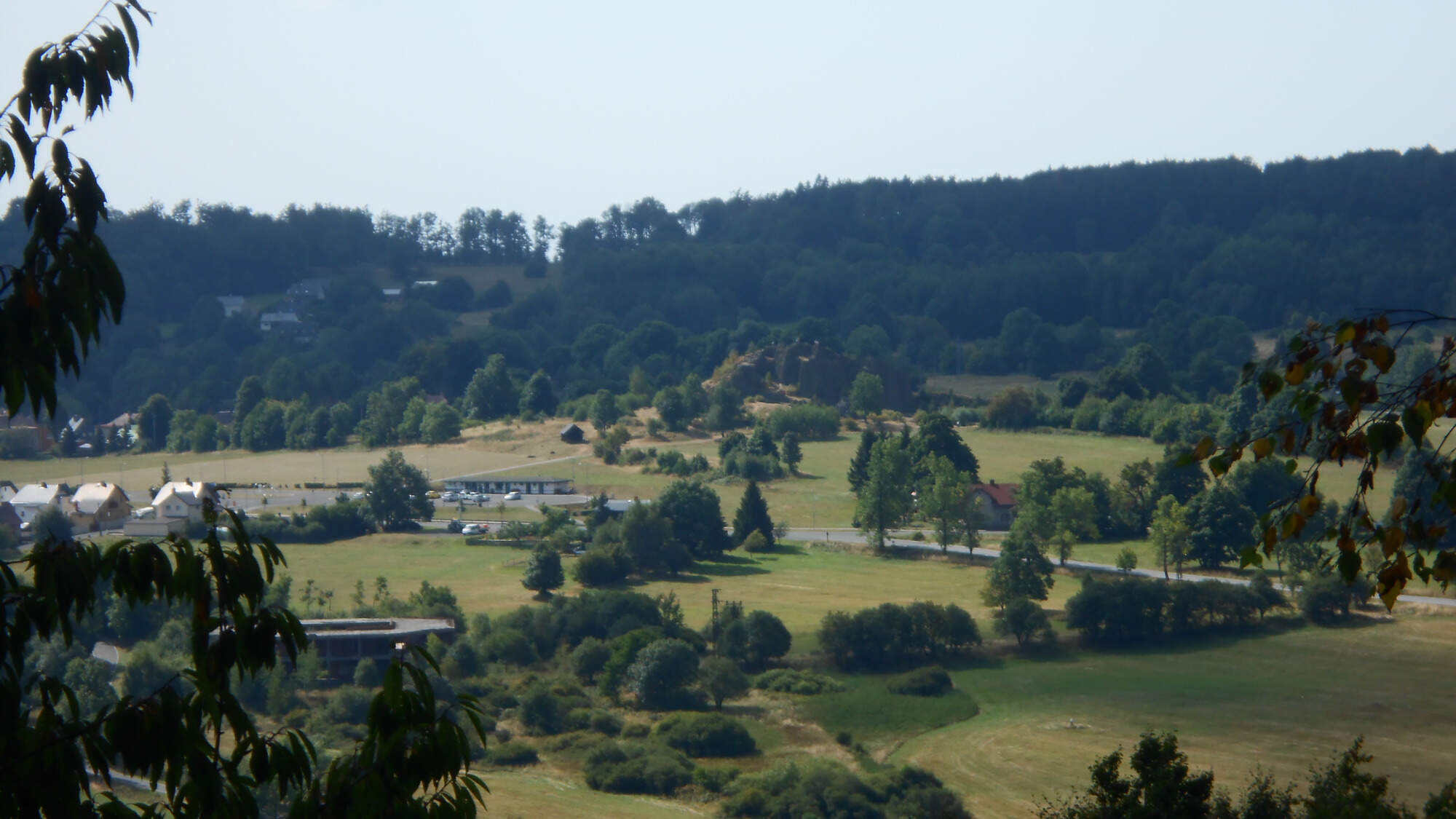
From the peak, I’ve tried to take a shot toward the basalt rocks, but despite my best tries both my phone and my camera failed to focus on it well, leading to two sets of blurry pictures.
From then, I descended the peak and wove through the woods to a peak with gentle grassy slopes…

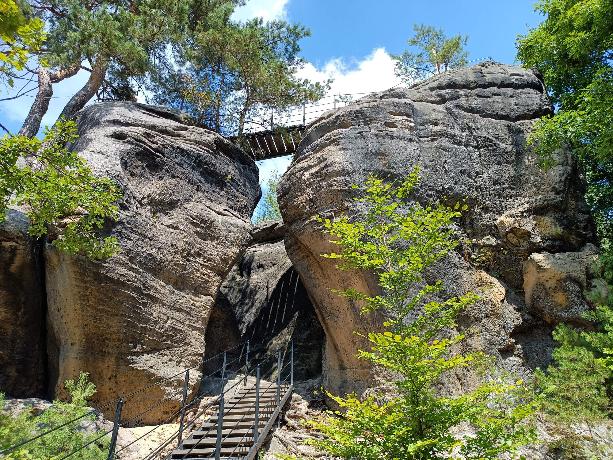
…towards another rock formation. This time, sandstone, so it wasn’t completely off-topic.
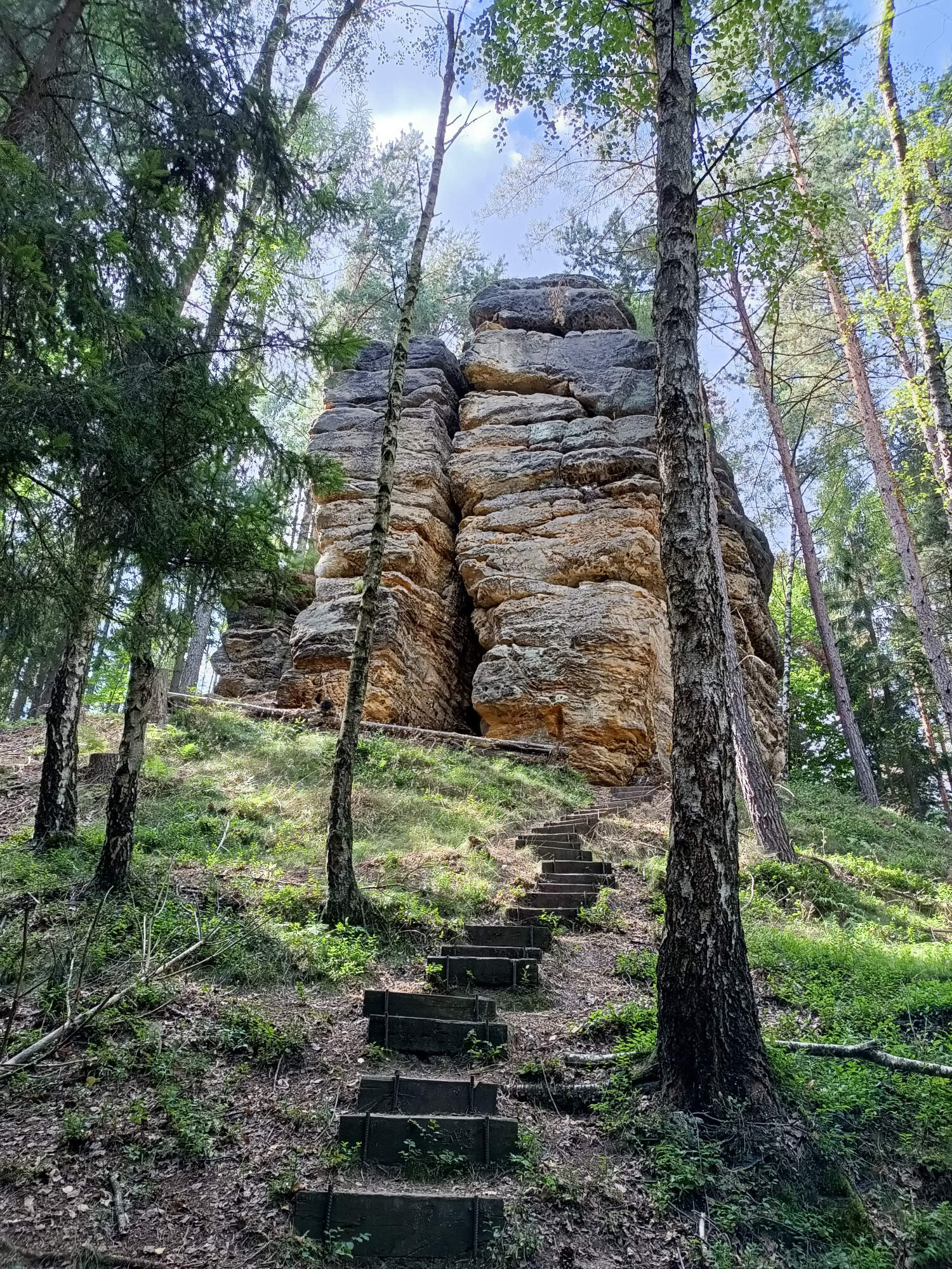
Weaving around, I reached a lookout that provided a sight of exposed rock formation, though the mineral wasn’t easily recognized across the distance. I’ve learned that the top hosted ruins of a castle, but it was out of reach for me – the footbridge across the river was damaged and not yet repaired.
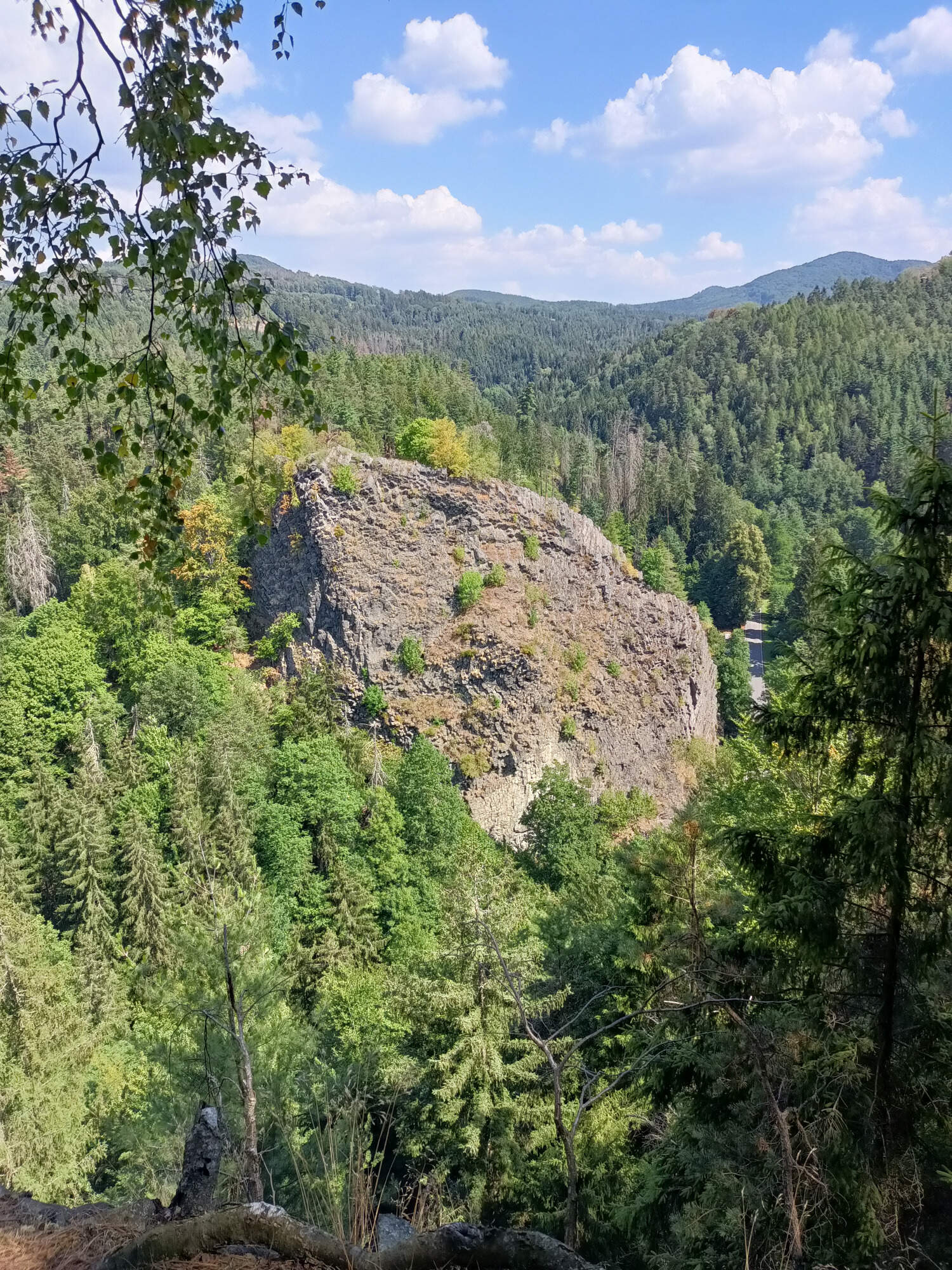
Thus, I delayed visiting the other side (further down that trail are some other basalt formations) to some other time, preferably within a decade. My journey continued on, around another lone sandstone spire.
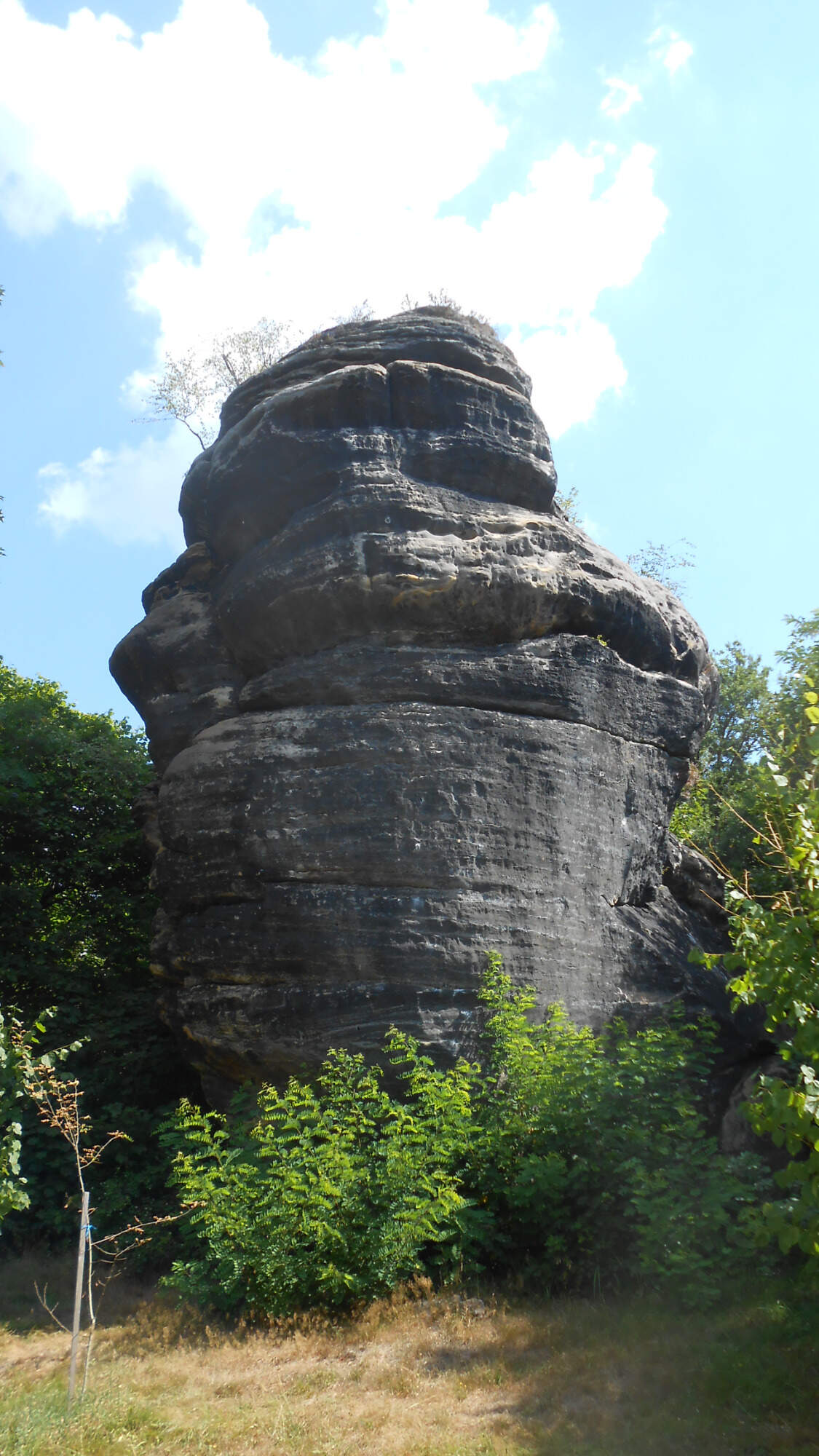
Crossing the small town, I ascended another hill. This lookout had the basalt columns lying down at angles from 0 to 20 degrees.
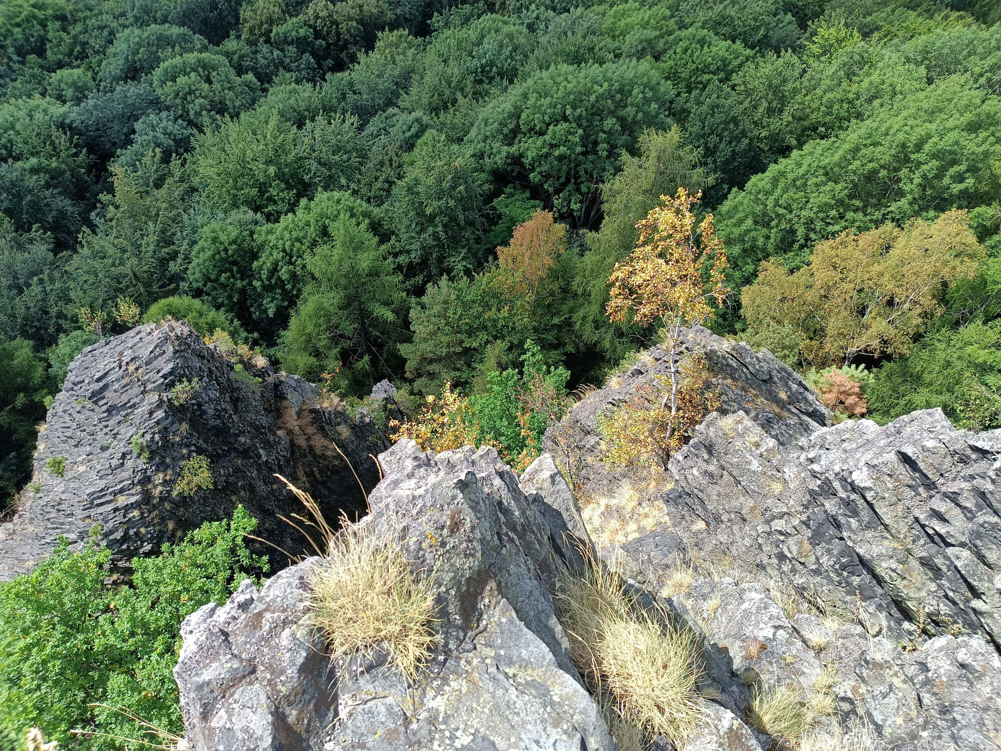
Nearby was another sandstone formation – three rocks connected by a set of footbridges.
By which point, I descended to the town again, to head to the train station and back to the hotel. While this hike was the shortest, I enjoyed it quite a lot.
Day six: carvings and hideouts
The sixth day had led us to places that were touched by human hands the most, and in quite a direct way. The beginnings were a bit more subtle – another long-abandoned ruin, though carved-out sections were visible in some places.

A nearby lookout allowed us to gaze upon the nearby woods, with a hint of other sandstone plateaus around.

Then followed a long section of trail that… had quite a scarcity of photo-worthy sights. It was either woods or fields, with just three small settlements on the way. I managed to take picture of a flower, not so common for me this late in the year. As often, I have no idea what it is.

Later, I reached a place with several plateaus, into one of which a hideout was carved. This one supposedly came from the medieval period and, unlike many others in the area, were in fact the hideout of brigands, not a hideout for common folk in the 30-years war.

With a simple wooden bunk arranged inside for illustration.

Just among those plateaus was a spire with a strange name: “Seven breads” [side-note: “bread” is a noun with normal plural form in Czech, so no “helper” words are needed]. I guess it looks like seven loaves of bread piled on top of each other with a bit of imagination…

The next rock formation was called “Frog cave”, though it’s a hollow with several entrances, not a cave.

Just a short distance further down the trail came the “carvings” part. In the mid-1800s, Václav Levý a sculptor (at the beginning of his career, merely a monastery cook) carved several motives into the sandstone rocks in the area. Some simple, some complex, with various themes.

During the dinner, we had a short discussion about whether the man was doing art or vandalism. Most likely both.

The largest (and iconic) carving is the “Devil’s head” carving, despite being one of his first works.

From this carving, it was only a short walk to the village where the sixth hike ended.
Given this was the sixth day, my legs were becoming a bit stiff and tired, but there were still places to see, and I would not rest until the last hike was done. The last two – with their own sights – will wrap up this series, presumably the next Sunday. Until then, I hope you had a lot of fun this summer.
