
Continuing my look back at my June hikes with another couple of returns to places I’ve visited before – one of those places had changed a lot since then.
19.6.2022 – Childhood memories
This hike led me to a place that was in my very beginning. Since then, I’ve returned there a few times, but mostly only to some selected parts of the trail.
Fact is, the section of trail between Maylý Polom and Velký Polom peaks is rarely walked and quite muddy even in warm weather. I’ve tried to find some photos of the 1997 and 1998 hikes but the gloomy weather led to only a few pictures that didn’t go that well through the scanner.

The 2010 hike was in early July – one of my first solo hikes. Leading mostly through woods, I haven’t taken pictures either (especially as I only had a phone with a dubious quality camera). Thus, the first photos I can share are from the 2014 hike that had only a small overlap. That was in late October with a chilly morning.

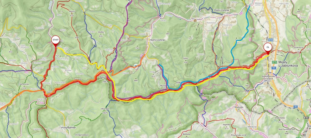
Returning to this place was quite an improvisation – after my move in late April, I wanted to try out how well the bus and train schedules work in several directions. This let me test one of them without repeating some of the more-used trails around. I admit I’ve avoided this place intentionally – with the trail being rarely frequented and being one of the few places with confirmed sightings of a brown bear as well as the muddy sections had me choose better places if I traveled in this general direction.

After leaving the resort at Bílý Kříž, I started following the border trail, which is, in many parts, quite beautiful (picture a bit above). Most of the trail then weaves through woods – in this part still standing (more on that later). Half-way through the border section is the chapel just below the “Muřinkový vrch” peak – where I hoped to have a comparison picture, but that’s not the case. Even back in 2010, the chapel was in the woods, and space for taking a decent photo was limited. My memory is hazy, but I presume it was renovated only after the 2010 hike, maybe only after the storms that decimated the forest around it, which was in the late 2010s.

The “Velký Polom” peak got the full brunt of that storm, leveling most of the woods around the peak. The lookout tower built in the early 2010s by a chalet below the peak had become quite redundant with no trees to block the line of sight.

Especially the trail crossing near the chalet has changed a lot with the forest completely gone (back in the late 1990s, it was in the middle of dense woods). The eastern slopes on my descent toward the valley weren’t spared either. I couldn’t recognize the woods where I spent a good chunk of time with my sister and my parents in summer 2001, 2002, and 2003. Simply because part of that wood was, likewise, gone. Saplings of various trees, combined with grasses, shrubs, and sometimes woodland flowers, had started taking over the exposed slope, but it’ll take decades before it’s a true forest again.

25.6.2022 – Slovakian wilderness
The last hike of the month was (similar to one hike in the previous post, two weeks before) delayed twice due to COVID restrictions. The plan was a loop around the “Zázrivá” village. Nestled between three mountain ranges and easily reached from neither, this was a trip where we didn’t really expect to meet other people. 40 people took part in this journey, though only 7 of us decided to take the longest, 30km loop.

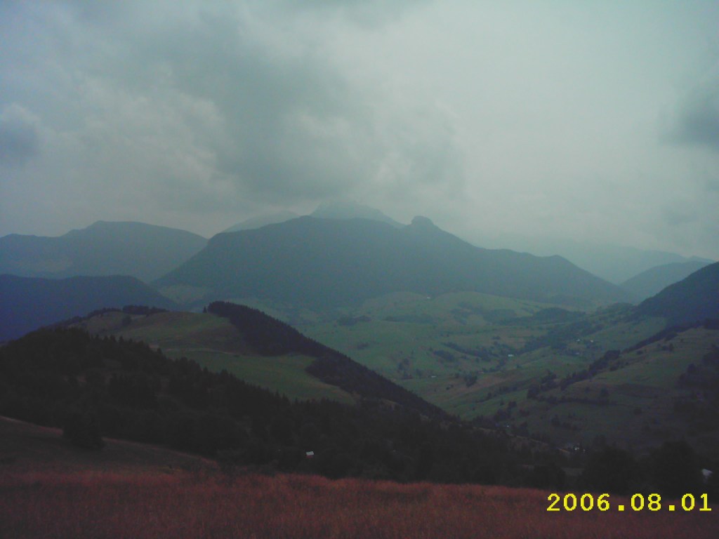
The village is surrounded by grassy hills roughly to the 1000m ASL mark, then it turns into dense woods. During my 2006 stay, I and my parents went for a short walk through the grassy section, but the fact it was a walk around the village and the weather wasn’t too great meant only a few photos were taken. With a camera that was a far cry from today’s quality.
After ascending to the “Javorinka” peak, the trail eased out, the following ascents and descents being quite gentle. The trail, however, often resembled a deer trail more than anything else.

At least until the later parts – near the Minčol peak, which is accessible from the Dolný Kubín town and thus a bit more frequented by hikers and bikers.

Up until this point, it was mostly cloudy – which was an advantage. By now, the sun started poking out from the clouds and, on the final descent, came out in force. This helped to some sunshine-filled photos on the way down.

Including blooming wild rose bushes.

And the surrounding landscapes.

Unfortunately, back in the village, I found that the ice cream stand my family frequented during our 2004 and 2006 holidays was nowhere to be found. Back then, they had really good ice cream for quite a low price (I guess locally sourced milk, given how many pastures are around). Times change, I guess…
Well, that’s my look back at two more hikes. In both cases, weather forecast wasn’t too great but it turned out fine. I hope the beginning of summer has seen you having fun, whether outdoors or indoors.

That’s really too bad about the ice cream stand, it’d be nice if they’d build another one. The chapel is beautiful though, as well as the other photos. It’s amazing how landscapes can change over the years.
LikeLike